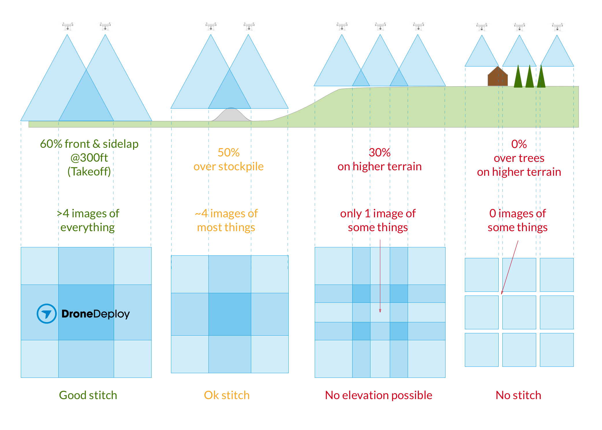
When your subject matter varies considerably in altitude, there are a couple of things you should be thinking about:
1) Ground Sampling Distance & Resolution
If you take off at the bottom of a deep quarry or hill, it's possible that the landscape around you may be higher than the height your drone is flying.
Equally, if you take off from the rim, your subject is going to be made of fewer pixels and so a lower resolution (higher ground sampling distance) in the final orthorectified image.
Consider using our Terrain Awareness feature which will allow your drone to maintain the same elevation over the ground as the elevation changes.
2) Overlap Percentage:
Stitching maps with high-quality elevation generally requires at least 8-9 images of each point on the ground. As you'll see in the diagram below, it's easy to drop below this with just a small change in elevation.
When flying from the base of hilly terrain, or terrain with tall buildings, trees or stockpiles, we recommend you increase your takeoff overlap to compensate.

If it's just a matter of terrain change changing your relative overlap, try our Terrain Awareness feature but if its a matter of objects or trees that our Terrain Awareness will not adjust for, try our overlap optimizer app to make sure your combination of overlap and flight altitude will provide for good stitching.