What are web layer overlays?
Web layer overlays allow you to add custom web layers from a tile layer URL directly onto your DroneDeploy maps. This feature enables you to visualize drone data alongside geospatial data from other sources—such as ArcGIS Feature Servers, Map Servers, or Tile Template URLs (XYZ)—to get the full context of your geographical information.
Availability
Enterprise subscriptions.
Available on Web and Mobile platforms.
How to add a custom web layer overlay
Follow these steps to add a new layer to your project.
Select Add: Navigate to the Overlays section (previously Project Files) and click Add.
Select Map Layer: Choose Map Layer from the list of options.
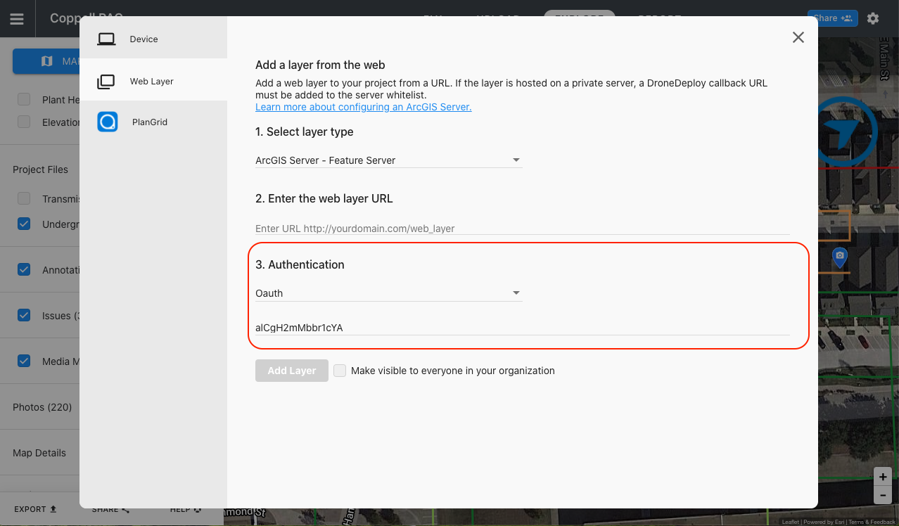
Select Layer Type: Choose the appropriate layer type from the dropdown menu (e.g., ArcGIS, WMS, WMTS, or Tile Layer).
Paste Web Layer URL: Enter the URL for your specific layer type. See the section below for formatting examples.
Supported layer types and URL examples
Different layer types require specific URL formats to function correctly.
ArcGIS Feature Server
This type of server is useful for applications requiring frequent updates and direct user interaction, such as asset management or field data collection.
URL Format:
https://services.arcgis.com/yourOrganizationID/arcgis/rest/services/yourFeatureService/FeatureServer/0
ArcGIS Map Server
Users can overlay multiple map services to create comprehensive visualizations. Note that you typically cannot interact with or edit the underlying data as you can with a Feature Server.
URL Format:
https://services.arcgis.com/yourOrganizationID/arcgis/rest/services/yourMapService/MapServer
Tile Template URLs
Tile Template URLs are commonly used with services like OpenStreetMap and Mapbox. They provide a scalable solution for integrating detailed map imagery.
URL Format: Ensure your URL includes the
{z},{x}, and{y}placeholders.Example:
https://a.tile.openstreetmap.org/{z}/{x}/{y}.pngNote: The
{z},{x}, and{y}placeholders allow DroneDeploy to insert the zoom, x, and y values to retrieve the correct tiles from the server.
Setting up OAuth
Some layers may contain sensitive information that requires authentication. DroneDeploy Web Layers support OAuth-based authentication.
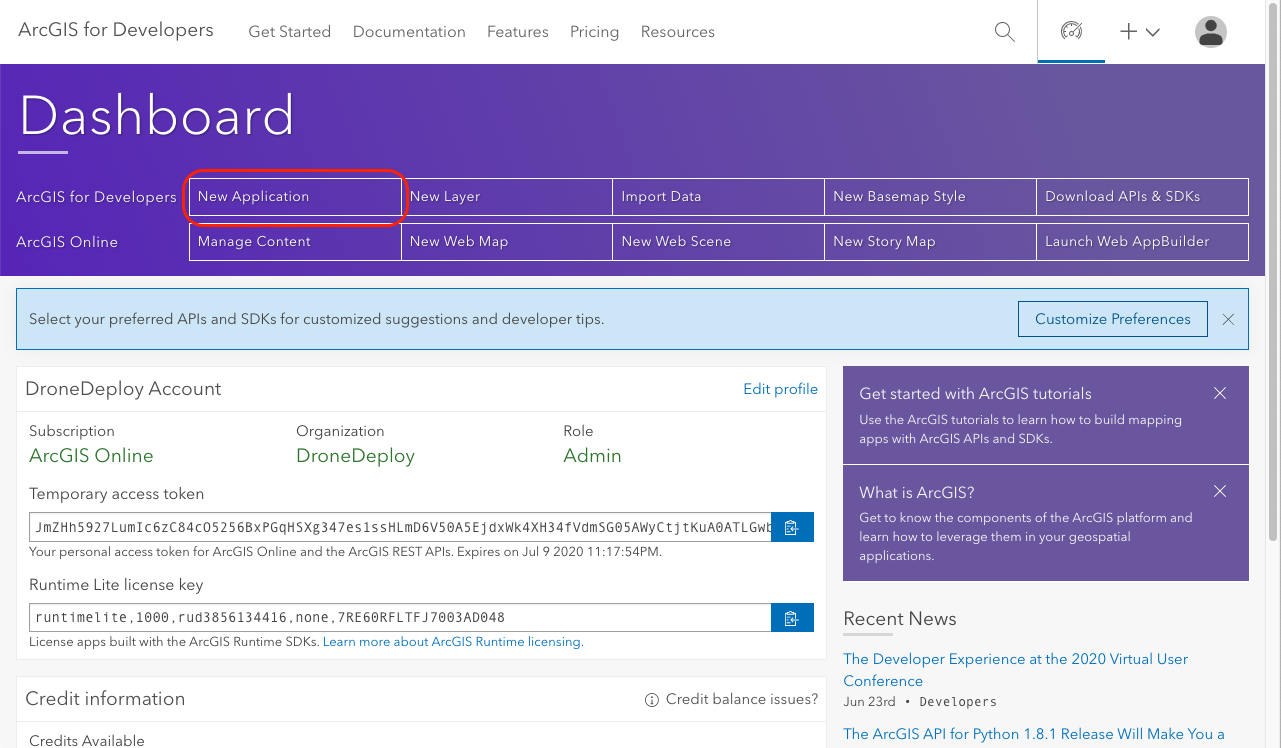
Step 1: Create an app Create an app within ArcGIS if you haven't already. Ensure authentication is enabled. If you are using ArcGIS Online, you can create an app at https://developer.arcgis.com.
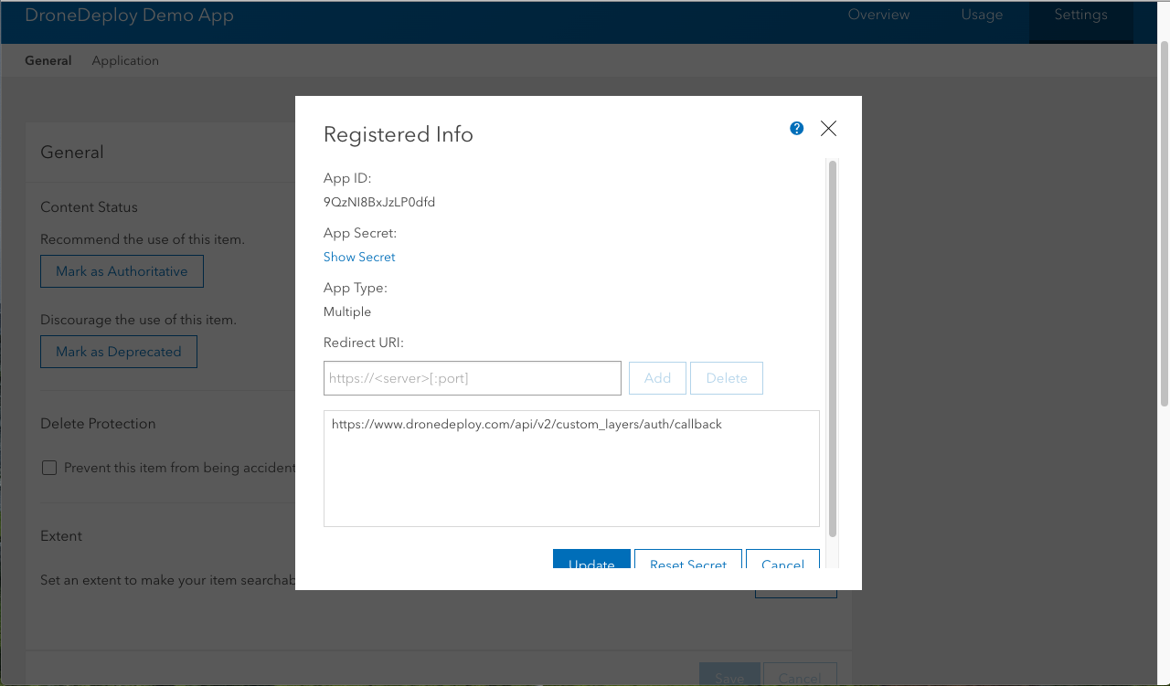
Step 2: Add the redirect URL Add the DroneDeploy redirect URL to your app.
Step 3: Copy the Client ID Copy the Client ID (App ID) from your ArcGIS app. When adding the layer inside DroneDeploy, select OAuth as the authentication mechanism and enter this Client ID.
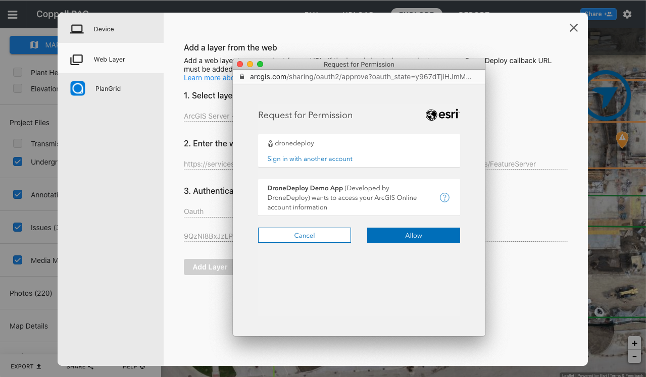
Step 4: Sign in You will be prompted to sign in with your ArcGIS credentials.
Note: Every user who wants to view this layer will need to sign in to their own ArcGIS account.

V2.2
