Overview
Resolution represents the level of detail achieved per pixel in your map. While several factors affect map resolution, the quality of your images and the altitude of your mission primarily determine the results. This article explains how resolution impacts your data and helps you choose the right settings for your project.
Understanding resolution and plans
Resolution varies depending on your DroneDeploy plan. To ensure you have the necessary 2D resolution for your project, review the subscription levels on the Pricing page.
Factors affecting resolution
To generate the best possible data, focus on your flight skills and equipment. Lower altitudes typically result in higher resolution (smaller cm/pixel values), while higher altitudes cover more ground but reduce fine detail.
Parking lot comparison
The following examples show the same map at different resolutions to demonstrate how the detail changes based on pixel size.
Map details:
Type of drone: DJI Phantom 3 Pro
Altitude: 180ft (60m) above ground level
Number of images: 271
Achieved resolution: 2.6 cm/pixel
Native resolution: 2.6 cm/pixel
At native resolution, lettering and symbols remain highly legible.
5 cm/pixel 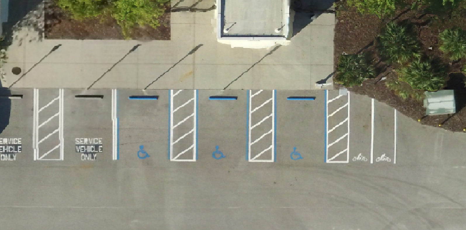
At 5 cm/pixel, letters and symbols are legible but show less detail than the native resolution.
20 cm/pixel 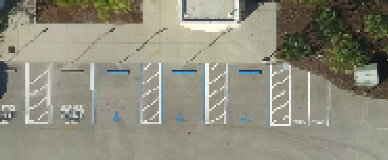
At 20 cm/pixel, words are no longer distinguishable, though some symbols remain recognizable.
v2.2