Overview
With the Climate app, you can seamlessly import existing field boundaries from your Climate FieldView account for flight planning in DroneDeploy. You can then export your orthomosaic, plant health, and elevation maps to your Climate FieldView account to analyze your crop health, create scripts, and scout based on DroneDeploy’s aerial data.
How to use the app
1. Install the Climate FieldView app:
Install the Climate FieldView app to your DroneDeploy account. Alternatively, you can search the app directly from your App Market icon in the top bar on your main dashboard screen.
2. Plan a flight:
Plan a flight as you normally would. Then, locate the Climate app on your DroneDeploy data page. The app will be located in the left panel below your Advanced drop-down menu. You can also select your field boundary directly from the Climate FieldView app to import as your flight plan. If your field has multiple boundaries, the boundaries will be merged and you can edit your flight plan as needed.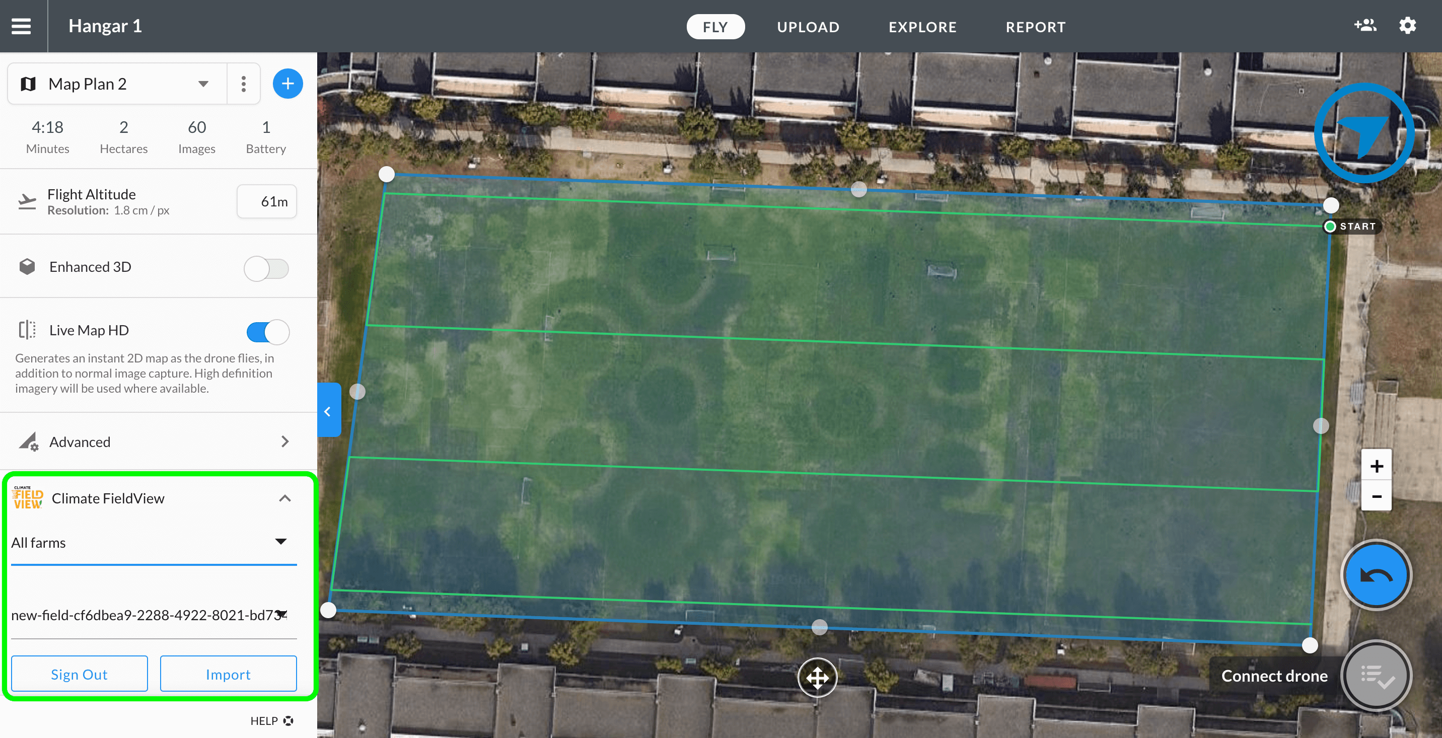
3. Fly your map:
Fly your field and upload your data. You can enable Live Map as you capture your images.
4. Export your map:
Once your map has completed processing, you can proceed to export your map to the Climate FieldView app. We support GeoTIFF, JPG, or PDF file formats of the orthomosaic, plant health, or elevation map.
Analyzing your DroneDeploy data in Climate FieldView
1. Log in to the Climate FieldView app: Please proceed to log in to the Climate FieldView app to view your image layers.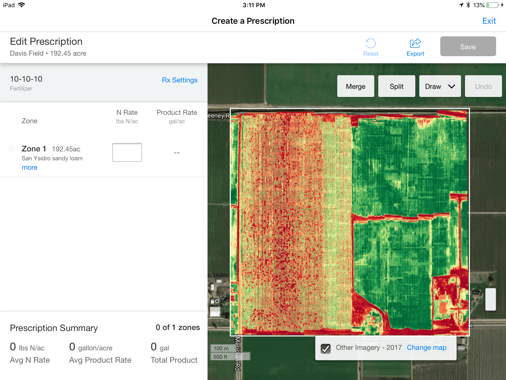
2. Navigate to the Script Creator: You can now navigate to the Script Creator to start adding customized prescriptions to your imported field.
Key considerations
Climate FieldView account is required. You will need to create or have an existing account with Climate FieldView in order to import your data from DroneDeploy.
The integration is available for Precision Ag Package, Individual, Advanced, Teams, and Enterprise customers.
Exports can take up to 1–2 hours to process depending on the size of your export. You will receive an email from DroneDeploy once we process your export, and you will also receive another email from Climate FieldView once they have received it.
Viewing image layers is only available on the Climate FieldView iOS app. Climate FieldView does not support third-party image layers on the web or on the Android app.
You cannot log in to your Climate FieldView account on a mobile device. Please log in on a desktop first before using the app on mobile.
Company links
Climate FieldView website: climatefieldview.com
Frequently asked questions (FAQs)
Q: What data do I receive from Climate?
A: Shapefiles of field boundaries to use for flight planning.
Q: When will I know if an export is ready in FieldView? How long does the export take?
A: Once DroneDeploy’s export is ready, you will receive an email from DroneDeploy. We will automatically export to Climate FieldView. Once Climate is done processing the export, you will receive an email from Climate that the image is ready to be viewed. This can take up to 1–2 hours as it is not instantaneous.
Q: Where can I find the image in Climate FieldView?
A: Climate FieldView will automatically associate the image to the nearest field. If a field is not near the image location, Climate FieldView will create a new field for you.
Q: Can I filter a field by farm?
A: The Climate FieldView Integration only allows for the retrieval of all fields. You cannot filter by farm or client.
V2.2