We’ve developed these tools with input from customers like you, and we welcome your continued feedback to help make them even better. Once you’ve tried these tools, we would really appreciate it if you would complete this brief survey to let us know what you think of the new tools.
If you are after more information about measuring stockpiles, here's a great guide: Volume Measurement with DroneDeploy.
Create Materials
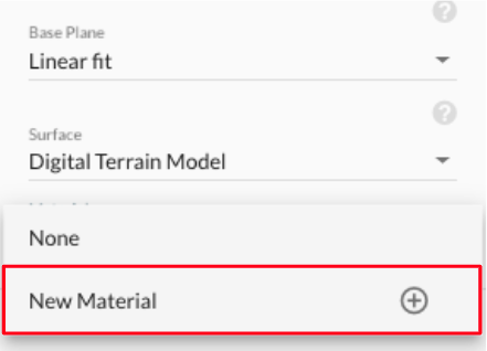
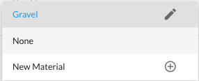
First, identify the materials that you have on-site. This material may be a general type of material (for example, topsoil, gravel or sand) or a very specific product type. These materials will be used to organize and summarize your stockpiles and calculate the total mass and value of your inventory. You can create a material by making a volume measurement clicking the "Material" drop-down and selecting "New Material."
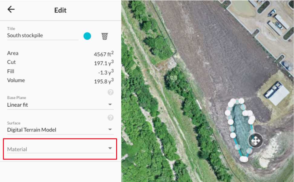
Then select "New Material"...
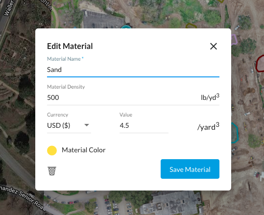
Then, enter the name, density and value of the material. A color for that material will be selected by default, but you can click on the color to pick a different one or to not associate a specific color with that material.
The material you've created will then be associated with that volume measurement. You can repeat the process to add more materials.
Select A Material For Each Stockpile
Once you have created a material, you can reuse it over and over again to label other stockpiles at that location or at other locations. Every material you have created will appear in the materials drop-down list and you can select it when making your volume measurement. For example, since we've already created the Gravel material, it appears in the material drop-down for all volume measurements.
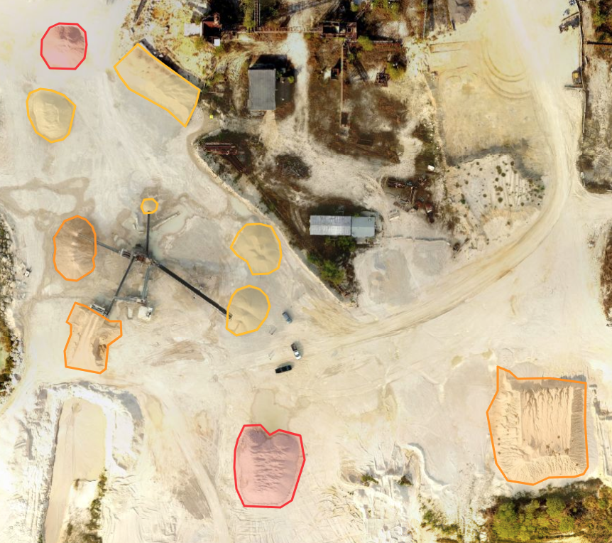
When you're done, all stockpiles on your map should be labeled with the appropriate material.
Tips For Making Many Stockpile Measurements
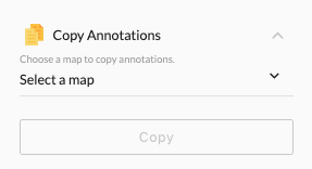
If you're managing tens or hundreds of stockpiles, carefully defining the perimeter of each one every time you fly might become repetitive and tedious. Fortunately, we have tools to help you automate the process. You can install the "Copy Annotations" app in the App Market and use it to copy volume and other annotations that you've already made on a previous map to a new map of the same location. This works especially well if your stockpiles mostly stay in the same place, but you can also adjust the perimeter of the volume annotations once you've copied them.
You can also consider using our Stockpile AI tool (available for Enterprise customers) that automatically detects stockpile perimeters and allows you to select them with a single click.
View The Stockpile Report
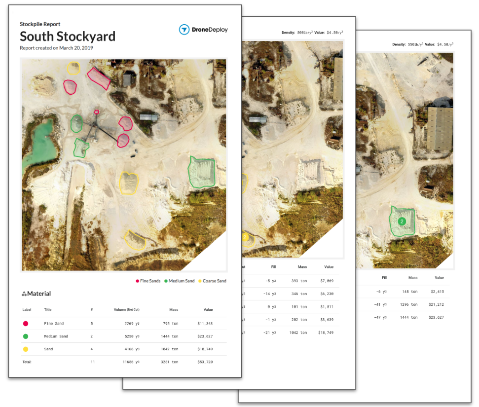
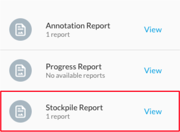
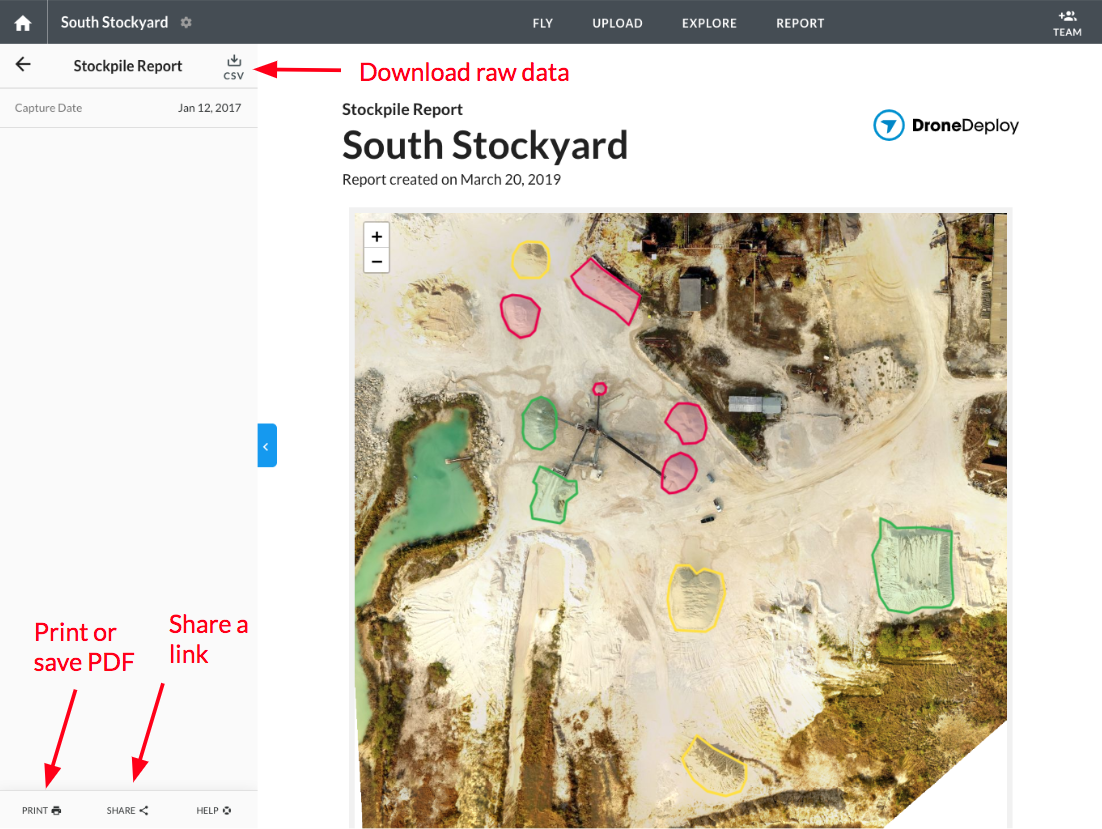
Volumes that have been assigned materials will appear in a new stockpile report, which summarizes the total amount and value of each type of material on site for a particular map date. To get to the report, go to the "Report" tab

and select "Stockpile Report".
From there, you can view, print, share or export the raw data from your report.
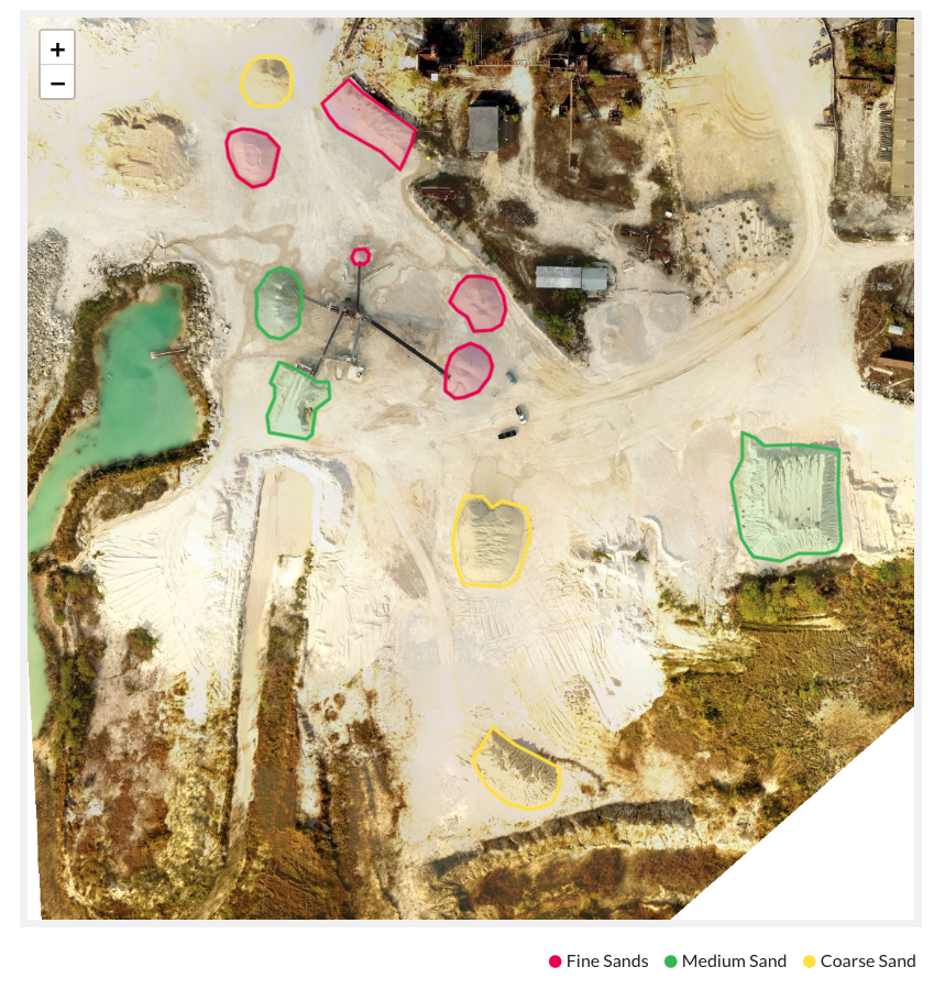
The report includes a map of the project with stockpiles represented in different colors based upon their material.
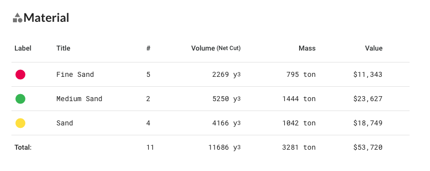
It also contains a summary table showing the total volume, mass and value of each material on site.
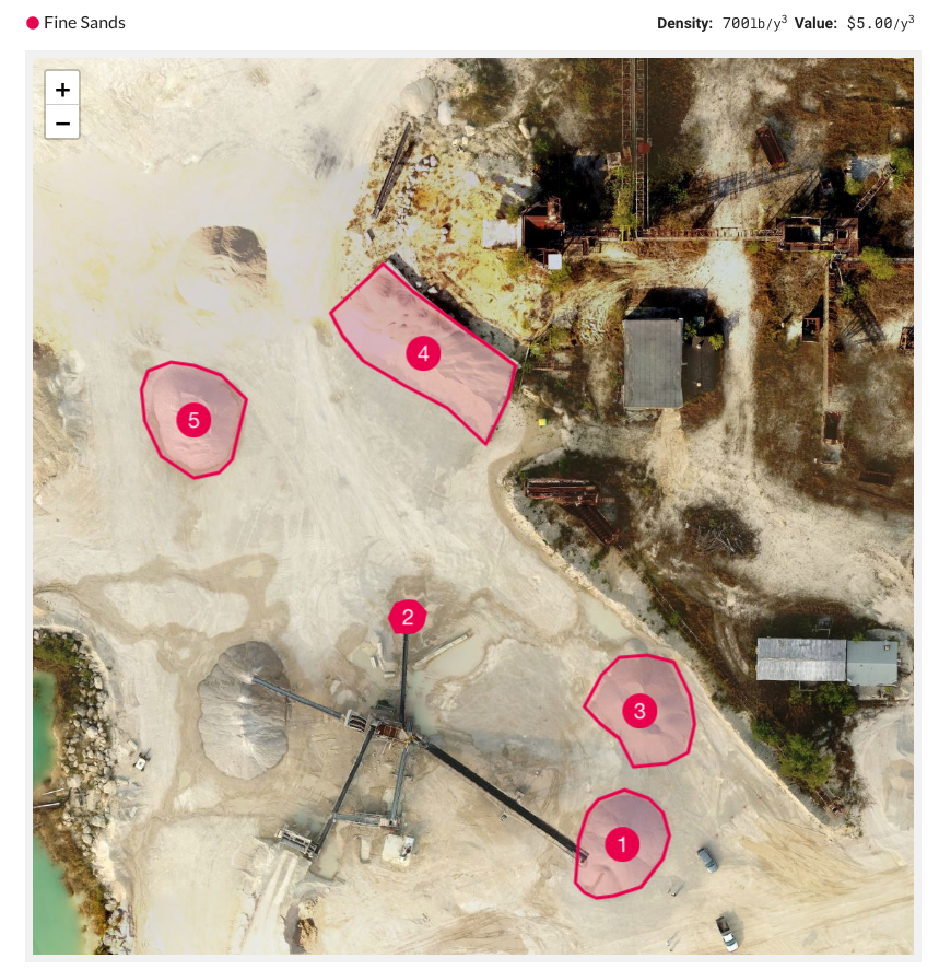
Individual maps and tables for each material type, like this one showing "Fine Sand", are also included.
If you want to export the raw values from your report (to format them in your custom report or input them into other systems), you can use the "CSV" button to download them.
