This guide provides the steps to export your data from DroneDeploy and import the resulting Elevation Map into the QGIS application.
Export Your Data from DroneDeploy
Follow the Exporting your Data guide.
Request a GeoTIFF Orthomosaic export.
Import the Elevation Map into QGIS
Open QGIS and start with a new project.
Click on the Add Raster Layer icon to import the Raster Elevation Map.
-
Select the file path to the TIFF file and select OK.

-
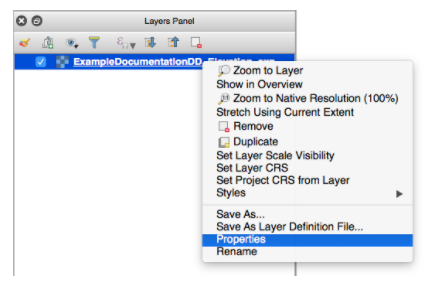
In the Layers panel, right-click on the newly imported layer, and select Properties.
-
Navigate your cursor to the Transparency tab and uncheck the box under No data value.
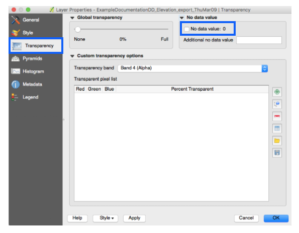
Finally, select OK to complete.
The elevation map is now displayed in QGIS with the correct color scale. 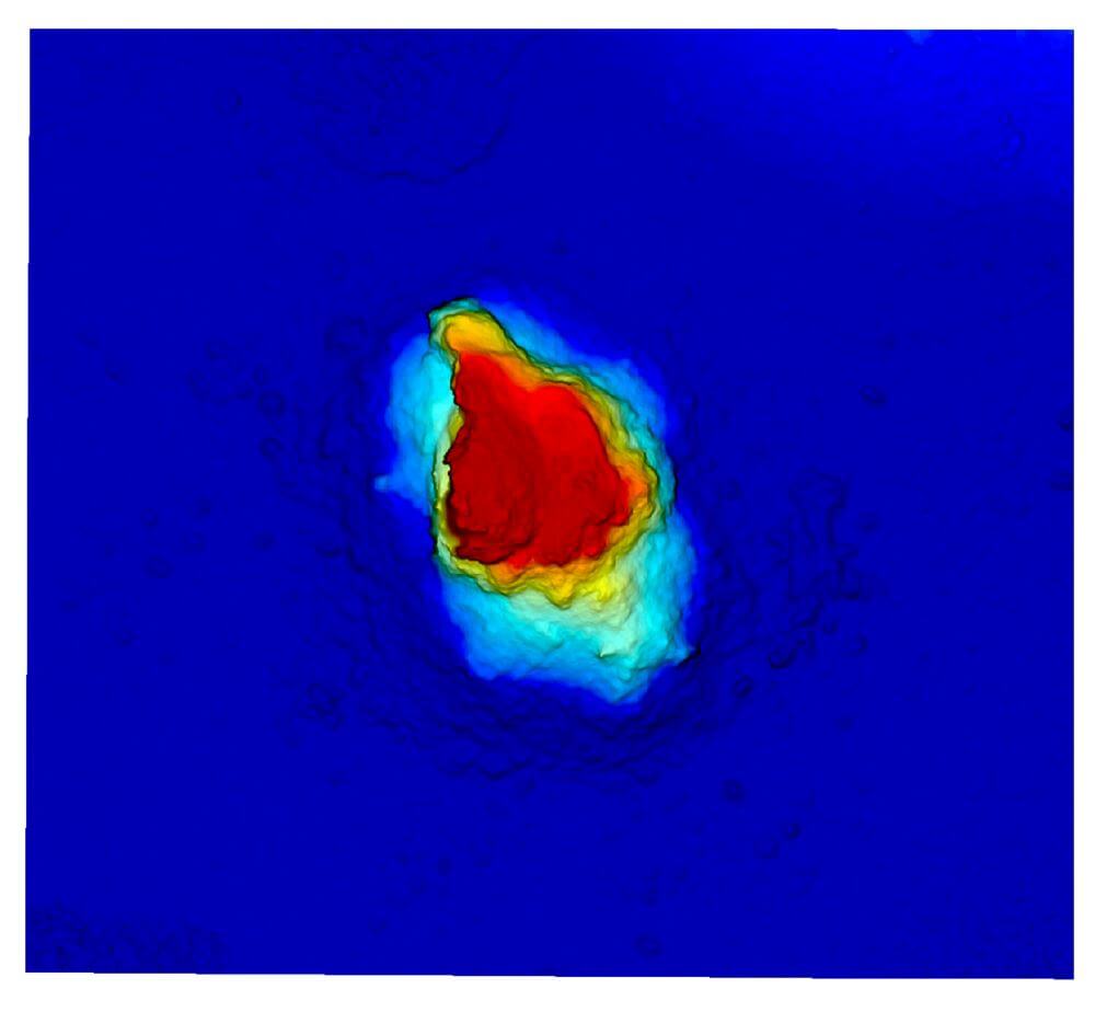
V2.2